
Treasure Island was originally slated to become San Francisco's second airport,operated simultaneously with Mills Field (now San Francisco International Airport However only after the exposition, the island was set to become a civilian airport—until the United States entered World War II. The Navy seized the land for the Treasure Island Naval Station and demolished the expo’s Art Moderne structures, leaving just the terminal and two hangars.In the spaces around them rose a little village of beige one and two-story sheds.
Images courtesy of Tim Tylercame from Paul Freeman's website.Abandoned & Little-Known Airfields:http://members.tripod.com/airfields_freeman/index.htm
Treasure Island Naval Auxiliary Air Facility, San Francisco, CA
When the thought that the City should create an international airport are accrued six sites were considered. They included Golden Gate Park, Presidio of San Francisco, China Basin, filled lands south of Hunters Point, the Lake Merced area, and the shoals north of Yerba Buena Island. Among six sites the area was ultimately chosen because it was accessible from all parts of the San Francisco Bay Area. Thus, Treasure Island was born. These watery acres were waste territory, until it was decided to create upon them the site of the Golden Gate International Exposition, to be known as Treasure Island during 1939 and thereafter to become an airport for the Trans-Pacific clipper ships.
Photos
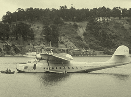
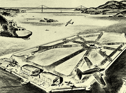
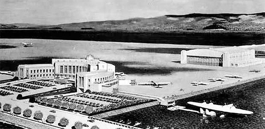
An undated artist's conception looking northeast at the planned Treasure Island Airport.
Building Treasure Island for International Exposition
The construction of Treasure Island began in 1936 & was completed in 1939. To build the 403 acre island, 29 million cubic yards of sand & gravel were transported to or dredged from the Bay & the Sacramento River delta. The name "Treasure Island" refers to the gold-laden fill dirt that washed down from the Sierras into the Bay, from which fill was dredged to create the island.According some sources Treasure Island was named after the famous adventure novel written by Stevenson. Approximately 259 thousand tons of rocks were used to create a rock wall to contain the island.When the engineers finished, a 400-acre island, a mile long and two-thirds of a mile wide, hadappeared in the Bay, connected by a 900-foot paved causeway to the Bay Bridge and equipped with ferry slips and landings for small craft and flying boats. With the help of federal aid, the construction of three permanent structures began, which later would serve the airport. The building consisted of a $800,000 administration building and two $400,000 steel and concrete hangars, each 335 feet long and 78 feet high, used temporarily to house the $20,000,000 art exhibits and the foreign treasures loaned for the Fair. Finally, around these structures, began to rise a $50,000,000 fantasy, which was America’s World’s Fair on the Pacific.
Golden Gate International Exposition
In the exhibit pavilions, visitors will see a $1,000,000 “mineral mountain” of ore with miniature models showing gold mining operations and a $1,000,000 relief map of Western America—so large that the borders of the States can be traversed on foot paths. They will witness demonstrations of the electric eye, television, electronic music, atom-smashing, chemical agriculture. The latest sub-stratosphere transport planes—even Douglas Corrigan’s famed “Corrigan Crate”—will be on exhibition. Forty or more foreign nations will exhibit in the International Building and Pacific Nations’ Exhibit Area; the United States and nearly half the States of the Union, in the Federal Building and Hall of Western States; the State and Counties of California, in the California Building Group. A cross-section of American business and industry will be displayed in pavilions and exhibits valued at more than $15,000,000—the Halls of Varied Industries, Electricity and Communications, Foods and Beverages, Homes and Gardens, Mines, Metals, and Machinery, Science, and Vacationland. The Fair’s Gayway, a mile-long circular boulevard, will be lined with showplaces—the Chinese City, Hollywood Boulevard, Streets of the World, and many others.
Map of the Golden Gate International Exposition at Treasure Island
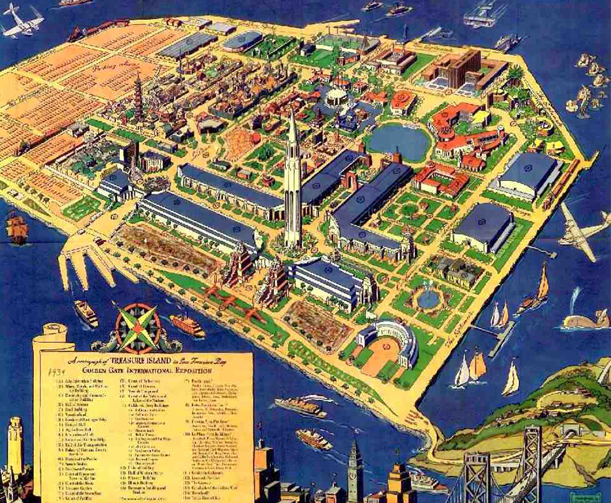
![]() Click on the image to see projected plan of Treasure Island
Click on the image to see projected plan of Treasure Island
Conclusion of the Golden Gate International Exposition on Treasure Island
As planning for the celebration progressed, organizers expanded the focus to encompass all the countries and continents surrounding the Pacific—with San Francisco as the gateway—and called it the Golden Gate International Exposition. Coming as it did during the Depression, the Exposition (as well as the two bridges) was a godsend to the state and local economy. Out-of-work architects, engineers, craftsmen and women, and artists were able to find work and expression in commissions for the Exposition. The theme of the Exposition was “A Pageant of the Pacific,” emphasizing the unity, heritage and melding of cultures that share the Pacific Ocean. The eclectic blend of Oriental, Occidental, and South Pacific art and cultural symbolism emphasized harmony and unity. The Elephant Towers at the west entrance blended Oriental design and Mayan architecture. The Fountain of Western Waters in the Court of Pacifica featured sculptures representing Asia, North America, the Pacific Islands and South America at its compass points.
Color Shot from ground level of the San Francisco World's Fair on Treasure Island.
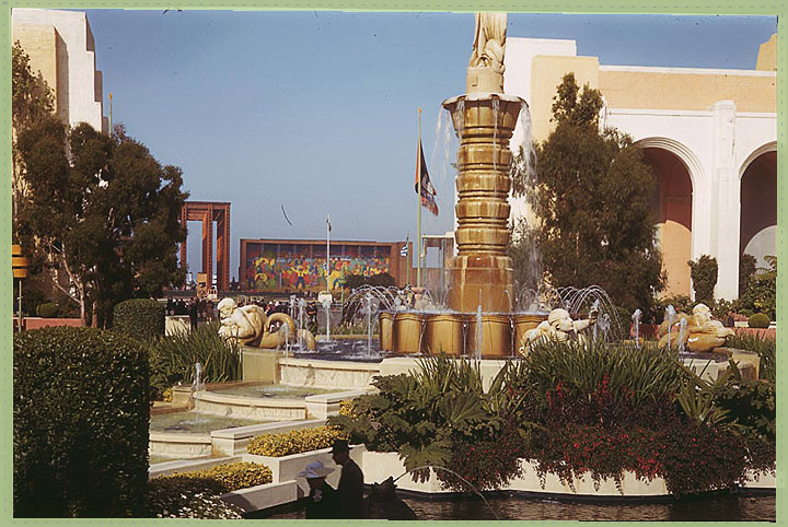
Charles Cushman Collection: Indiana University Archives (P01889) Foundsf.org
Satellite Maps
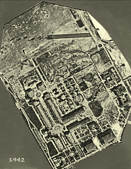
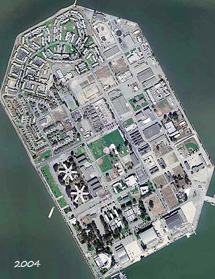
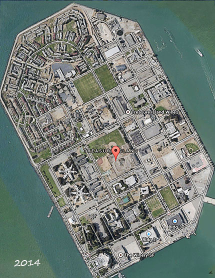
![]() Mouse over on 1942 to display 2014
Mouse over on 1942 to display 2014
